
Hiking in the picturesque British countryside
This is definitely a must-do hike if you stay more than a week-end in Bath. It was my favourite walk in the area since it allows you to distance yourself from the chaos of the city especially during week-ends and spend some “me time” wandering through flowery meadows, atmospheric woodlands where only the birds’ singing and squirrels jumping from branch to branch can be heard.
The trail is well signalled by the National Trust yellow symbols easily guiding you till the end of your journey. Pack you picnic, get ready to start your hike and see lovely quintessential English landscapes!
Here is the National Trust map and the hike details:
Facts About the Hike
Distance: 6 miles/ 9.6 km
Elevation Gain: 700 meters ascent/700 meters descent
Time: 3-4 hours
Difficulty: Moderate
Map: You can take a National Trust map of this hike at the tourist office, or download it from their app or you can use the ViewRanger app to have the detailed directions step by step. The hiking trails are well marked and easy to follow.
When to go: This hike is best during the spring and summer months, when the wildflowers are in bloom.
Bring: Hiking shoes, water, snacks or lunch, a waterproof light jacket (remember you are in UK!), and of course, your camera.
Getting to the start of the hike
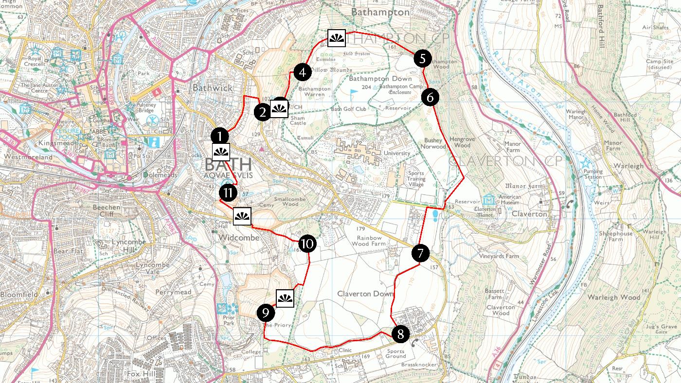
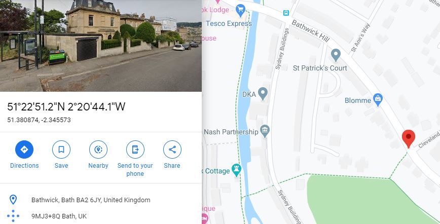
You will start your hike clockwise from point 1 “Cleveland Walk” at the top of Bathwick Hill. Since there are no car park nearby, the best way to get there from the city centre is by foot or by bus.
By foot from the Abbey: take York Street and once you are at the end turn right, then cross Pierrepoint Street onto North Parade. Continue over the river to T junction. Cross straight over road onto footpath, going under railway. At canal turn right and soon after turn left over canal footbridge and up steps to Sydney Buildings. Cross the road onto footpath opposite. Continue straight on for 150m and turn left to Bathwick Hill. You are now at Point 1.
Alternatively: go to the Sidney Gardens and cross the white gate leading you to the canal. Turn right towards South and walk until you find a small white bridge at the locks level taking you uphill. Go always straight ahead, take the steep flight of stairs leading you to Bathwick hill. Once you are there enter the gate signalled by the National Trusts symbols, cross the field and go towards the highest point where a carved bench is. This is your starting point.
By Bus: From the city centre bus station take the U1 bus (Bus Stop behind the Abbey – direction towards University of Bath) to the Cleveland Walk bus stop on Bathwick Hill.
On the trail
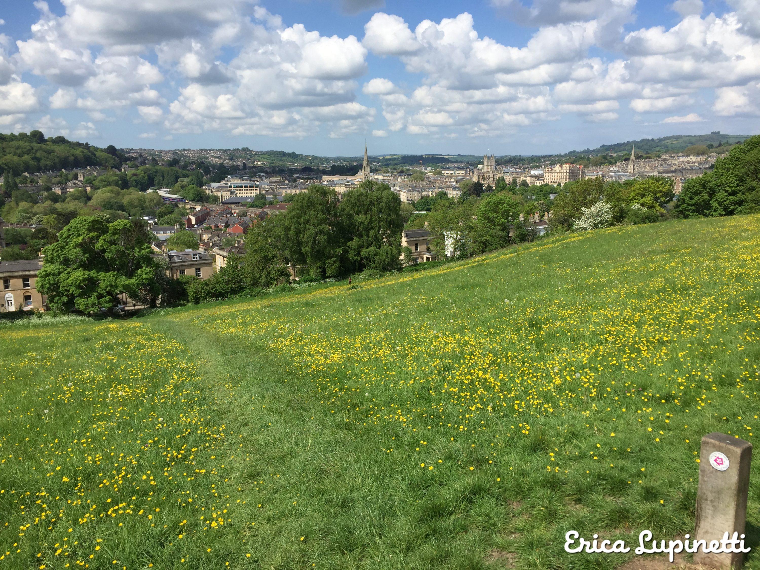
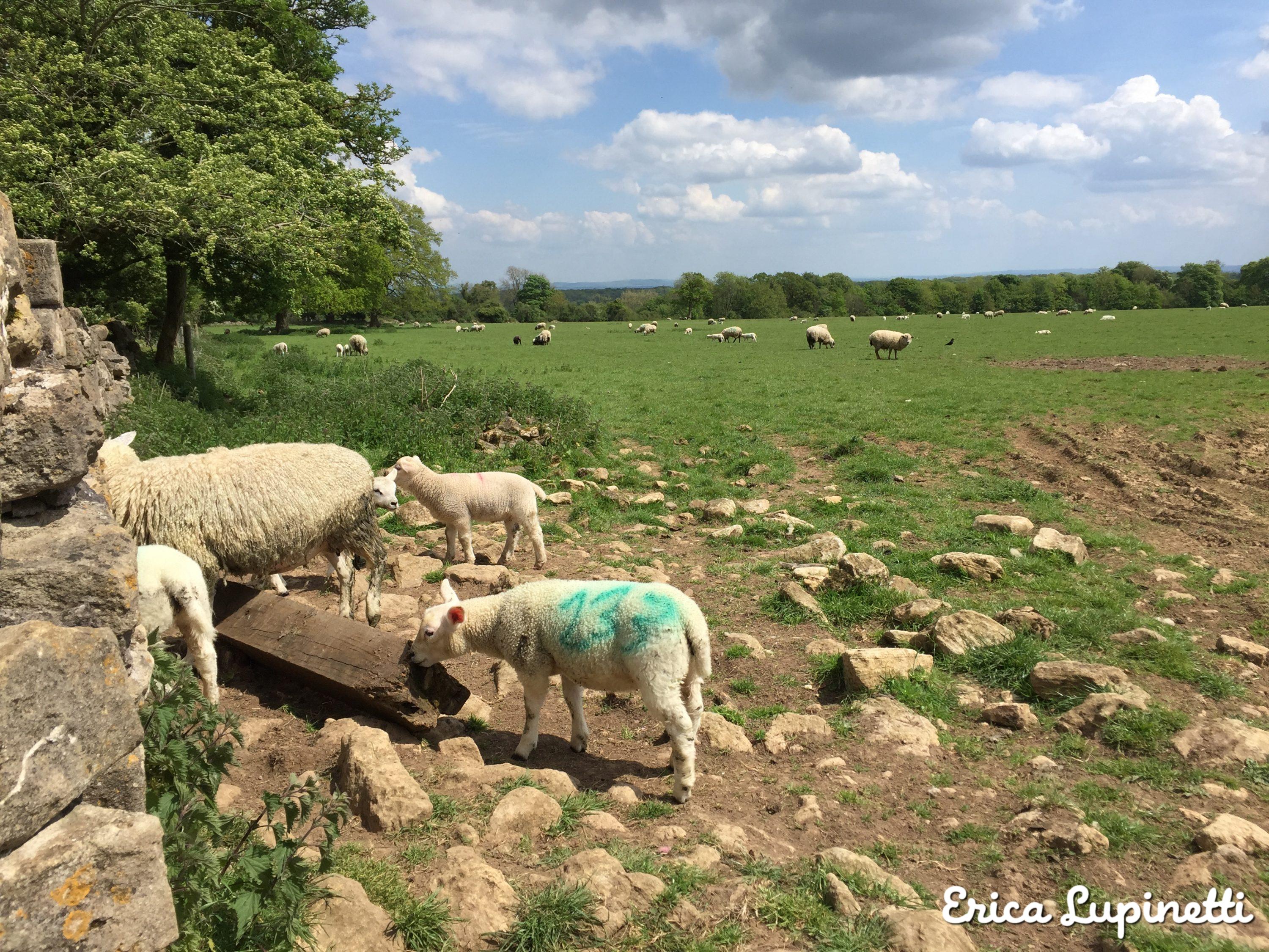
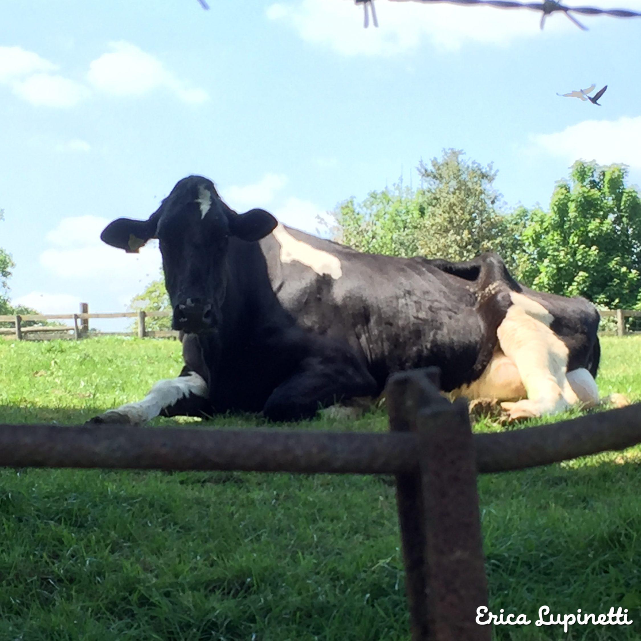
The Trail presents 11 points and a variety of landscapes offering post-cards views over the city of Bath and the hills surrounding it. It is not unusual to see animals grazing peacefully in the meadows, so keep your dog at your lead at least at the beginning of your walk.


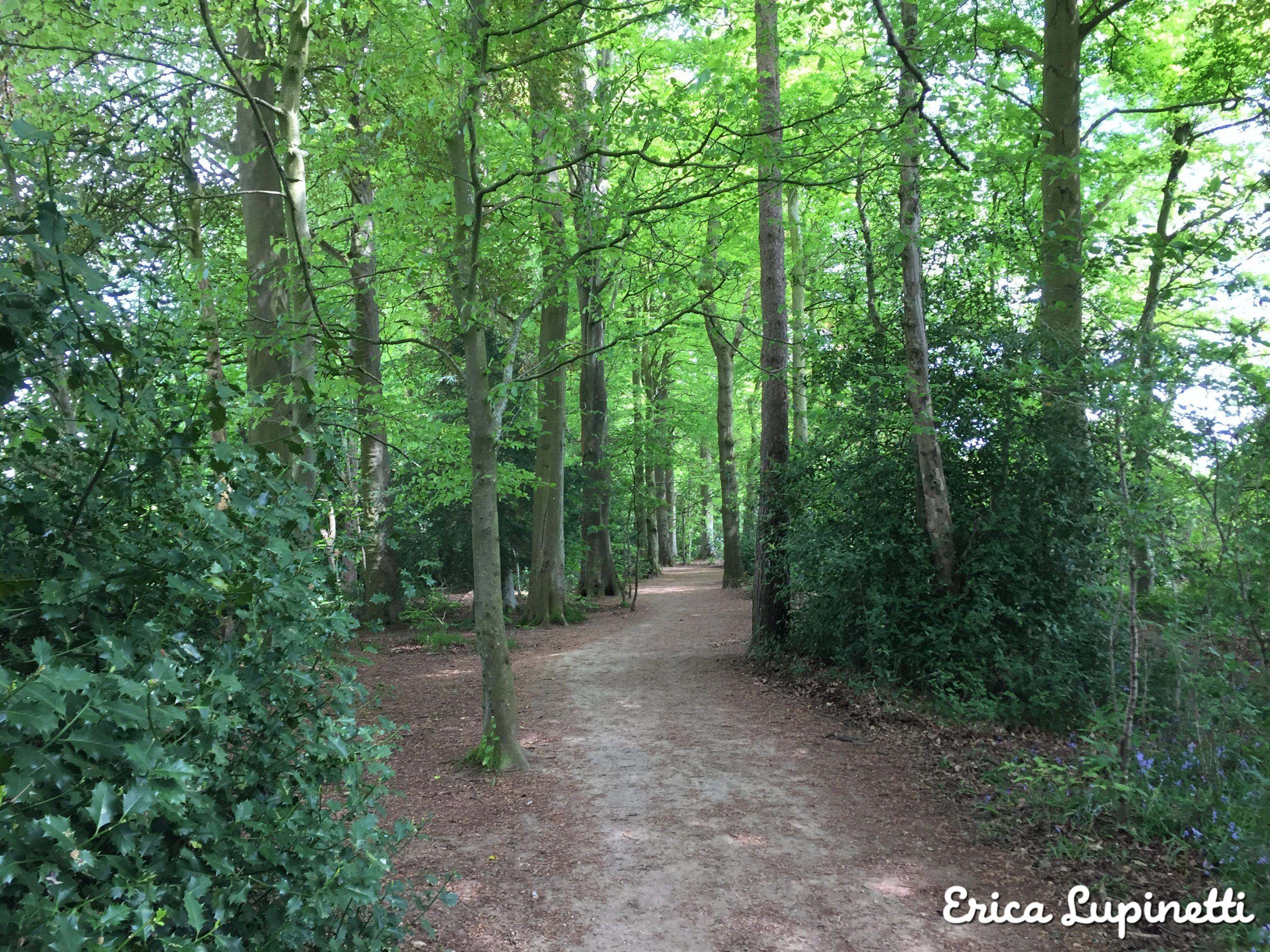
You will cross dense woodland forests with bluebells fields feeling like in a magical tale where moss and ferns cover the muddy path and the only company you have are squirrels, butterflies and birds.


The famous 3D animation film “Shaun the Sheep” is made in Bristol film studios and it is inspired by the multitude of fields in UK populated by sheep and farms. These friendly sheep are an added bonus to this idyllic path in the English countryside.

An idyllic picnic spot with lovely views over the valley at 360°.


My favourite section is the one crossing the woods where the breeze plays with the leaves and creates light games.

Lovely local flowers can be found along the trail.

I also made some new friends on the road:


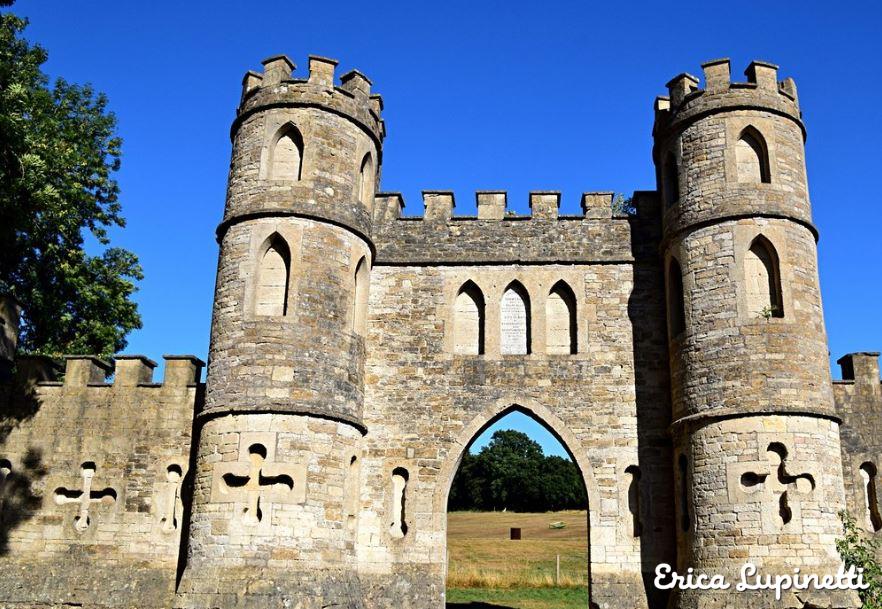
Sham Castle is a folly near the golf club which looks great at a distance and was commissioned by Ralph Allen, a philanthropist and self-made man who became mayor of Bath during the 19th century. The purpose was to improve the view from his mansion located in the Prior Park and to embellish the valley.
The hike takes about 4 hours in total including the picnic lunch and stops for the pictures.
It is my favourite city escape and a true breath of fresh air when you want to empty your mind and relax.
More information on hiking the Costwolds
If you are visiting the Costwolds Park and you want to optimise your holiday doing other hikes here are some suggested tools that can help you with the planning.
This guide is clear and easy to read with nice pictures and maps inspiring your next hiking adventure.

Walking in the Cotswolds: 30 circular walks in the AONB (Cicerone Guide)
This AA guide is an excellent summary of the most famous hikes you can do in the Costwolds National Park. If they are too easy for you, you can always join two hikes to make a longer one and challenge yourself further.

To know more about Bath read my articles about the most yummy restaurants, or the most scenic gardens of the city, and the top interesting museums and activities for Jane Austen’s fans and the best cocktail lounges of the city and much more!