
The ultimate guide to the most beautiful red footpaths
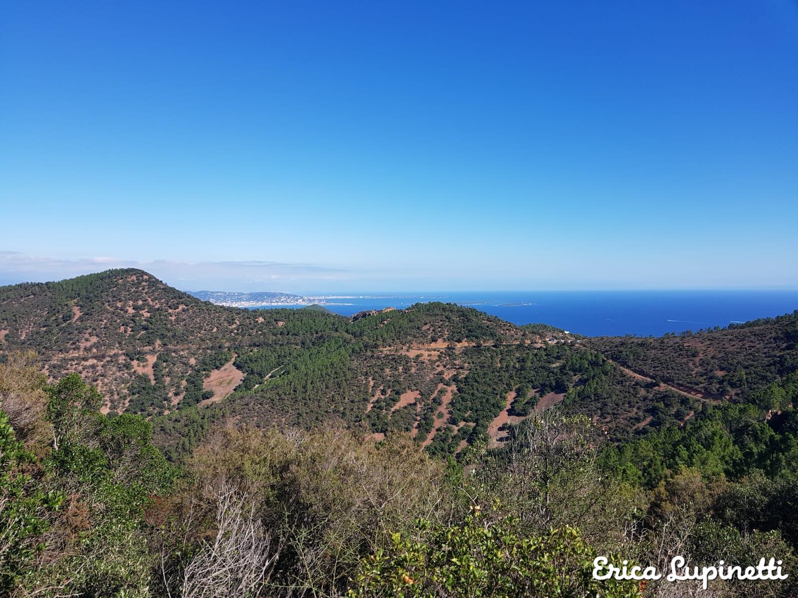
A Martian landscape stretches between the city of St. Raphael and Theoule sur Mer covering 14, 000 hectares of protected land where runners, hikers, mountain bikers or horse rider can find their favourite playground during all seasons. Cars and vehicles are forbidden in this fragile natural area threatened by frequent fires and wild construction of opulent villas and residential high-end areas.
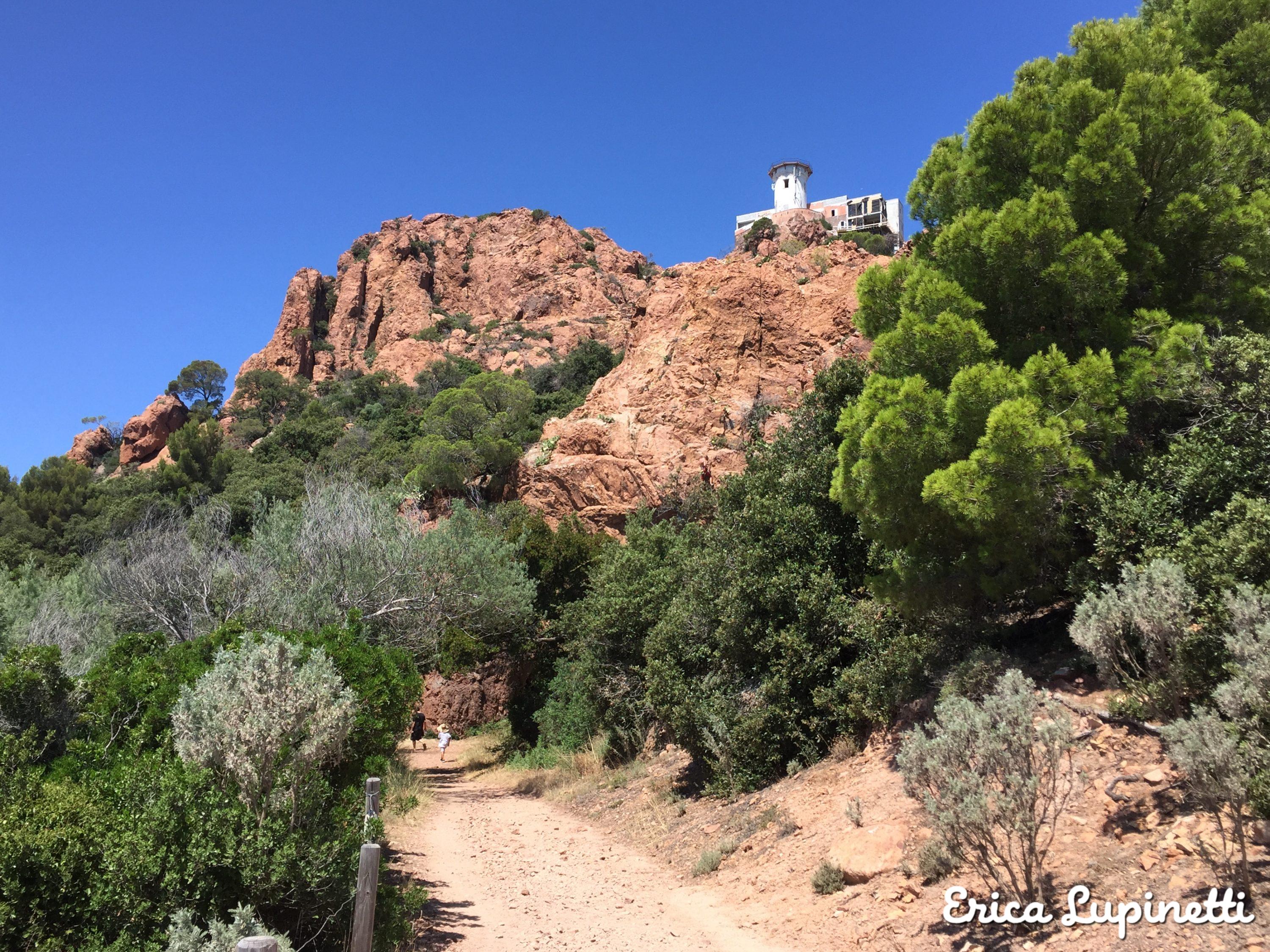
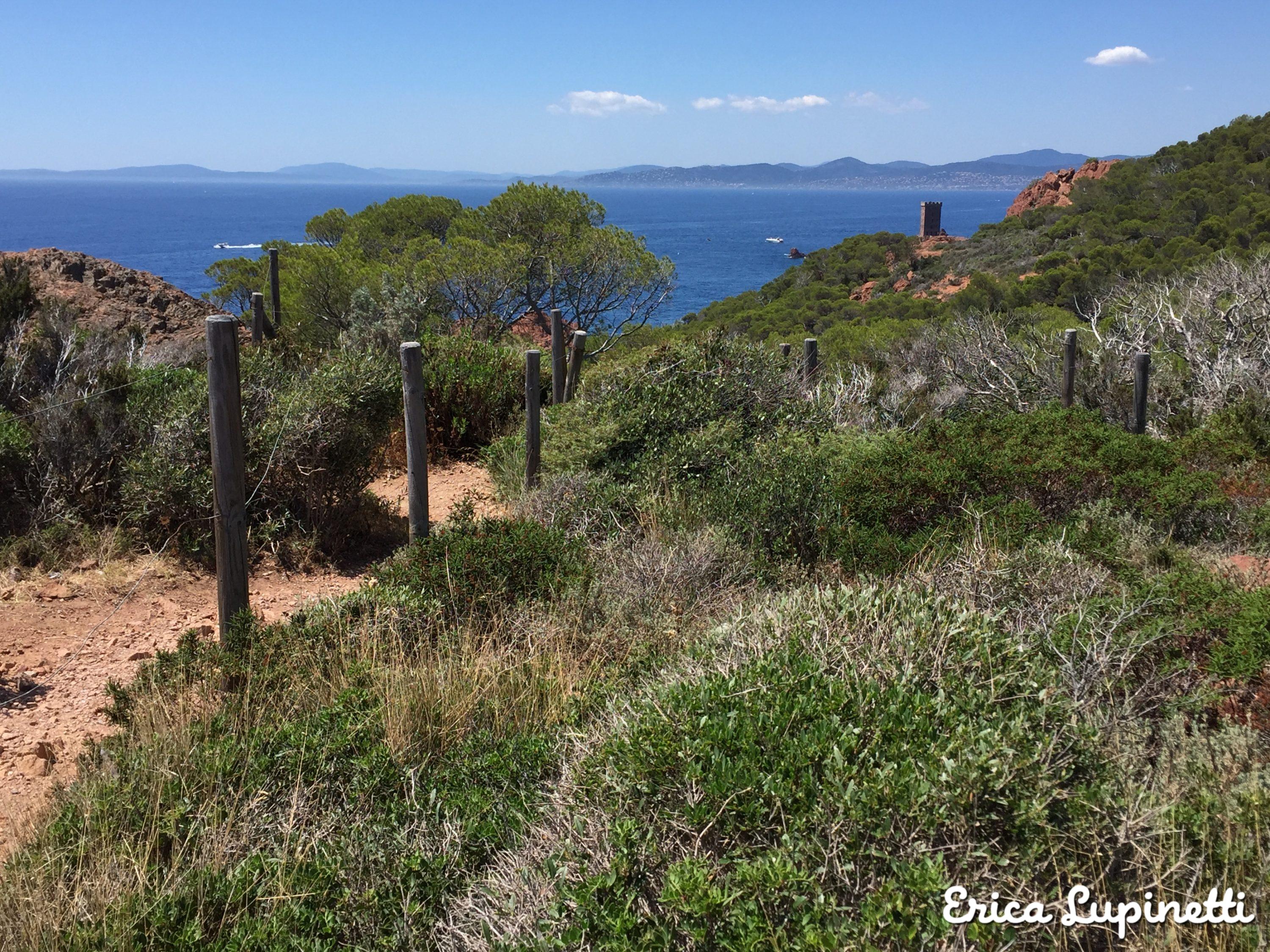
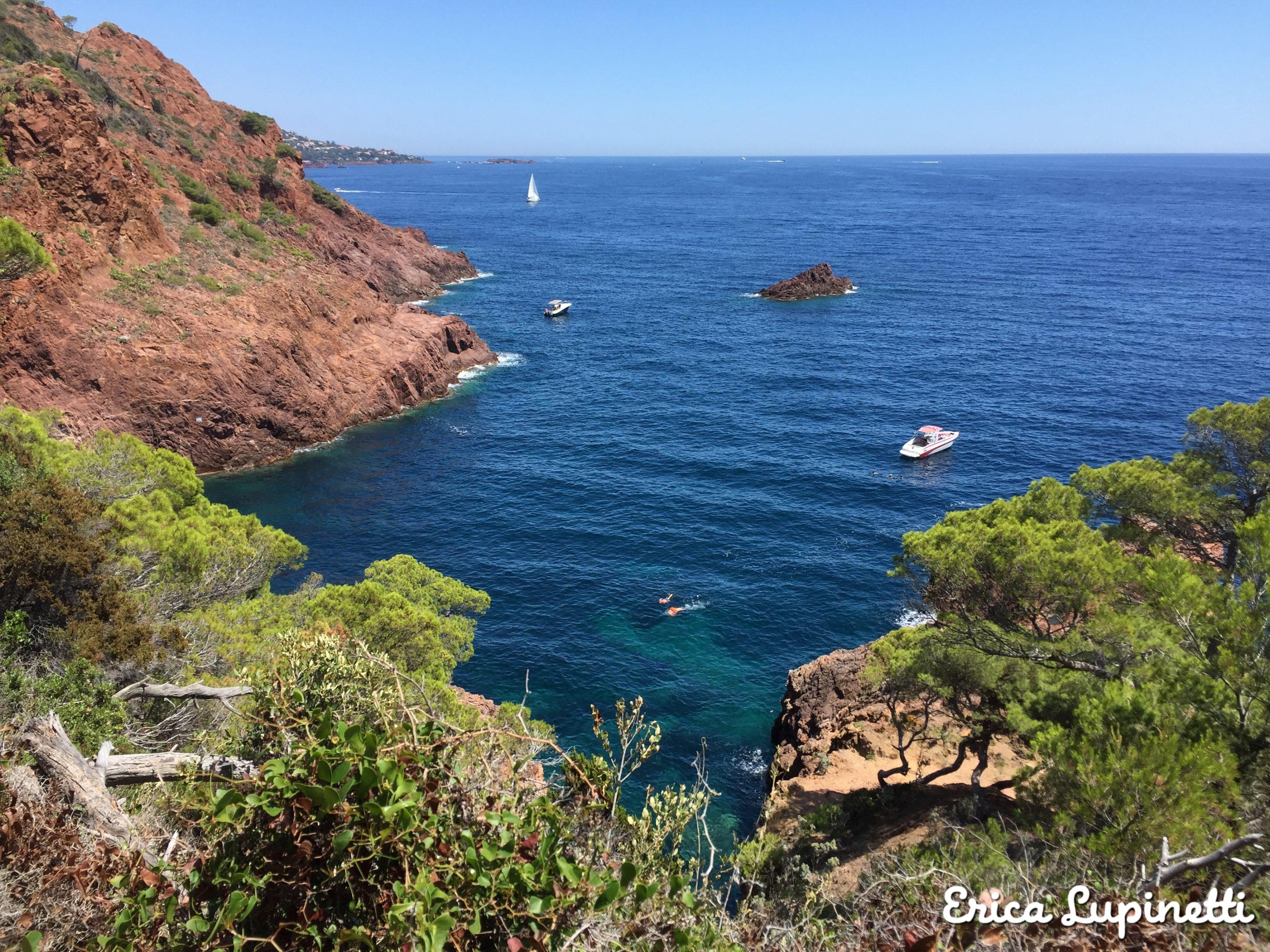
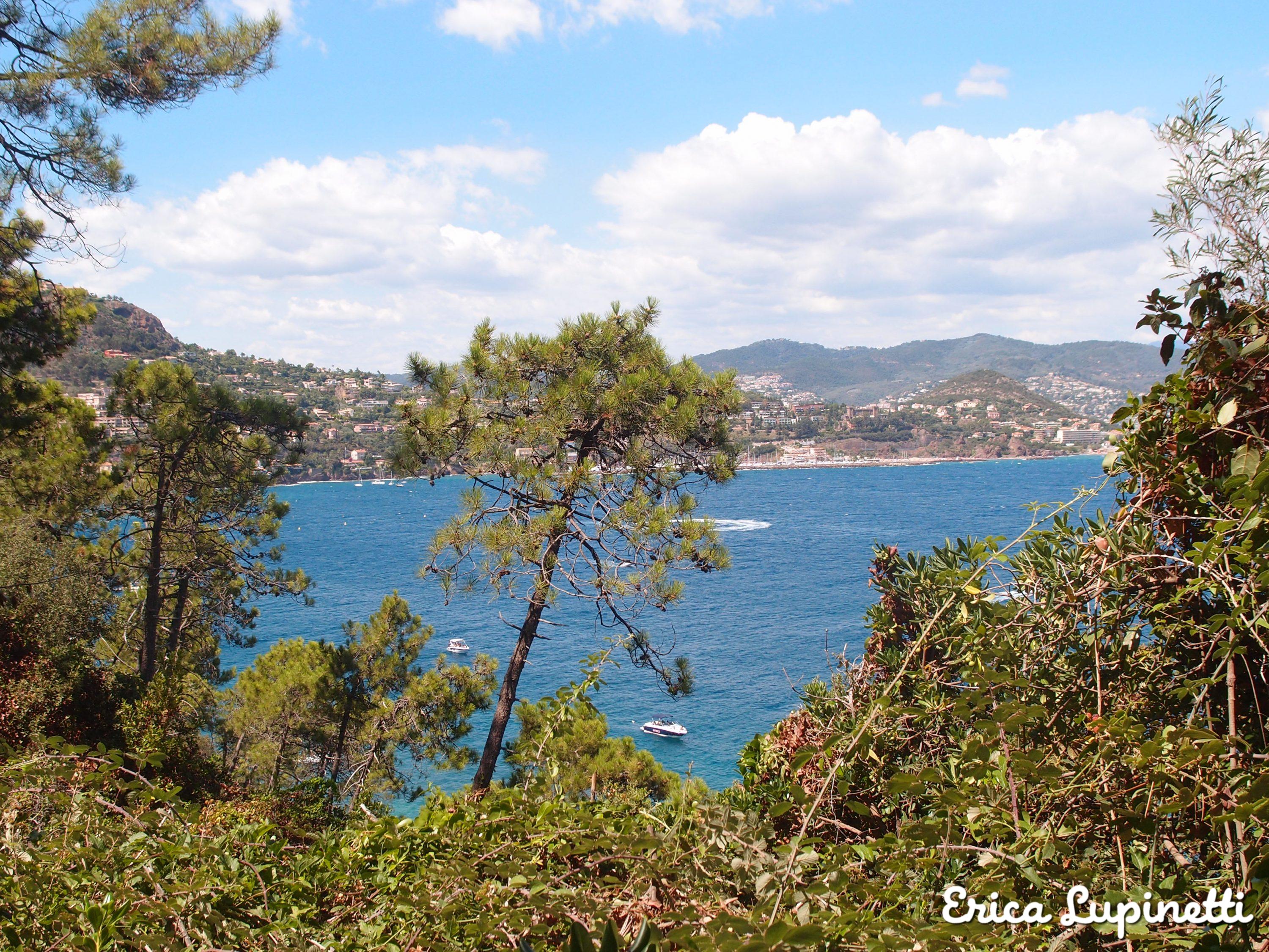
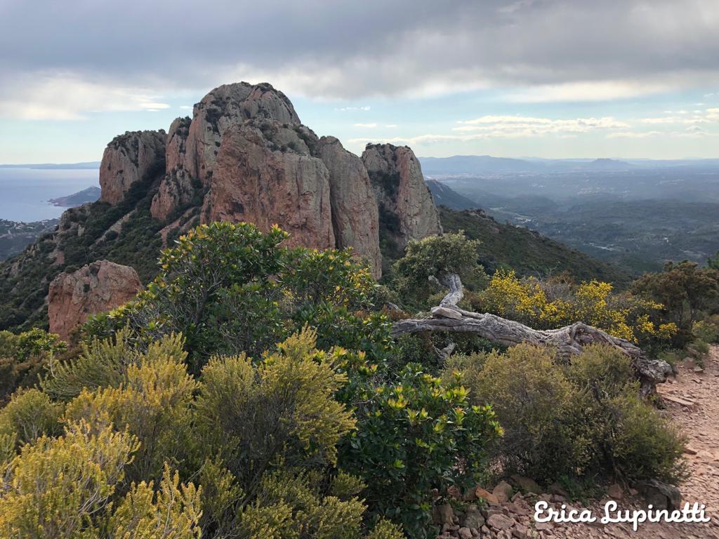
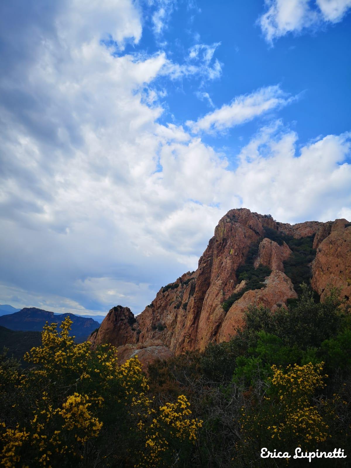
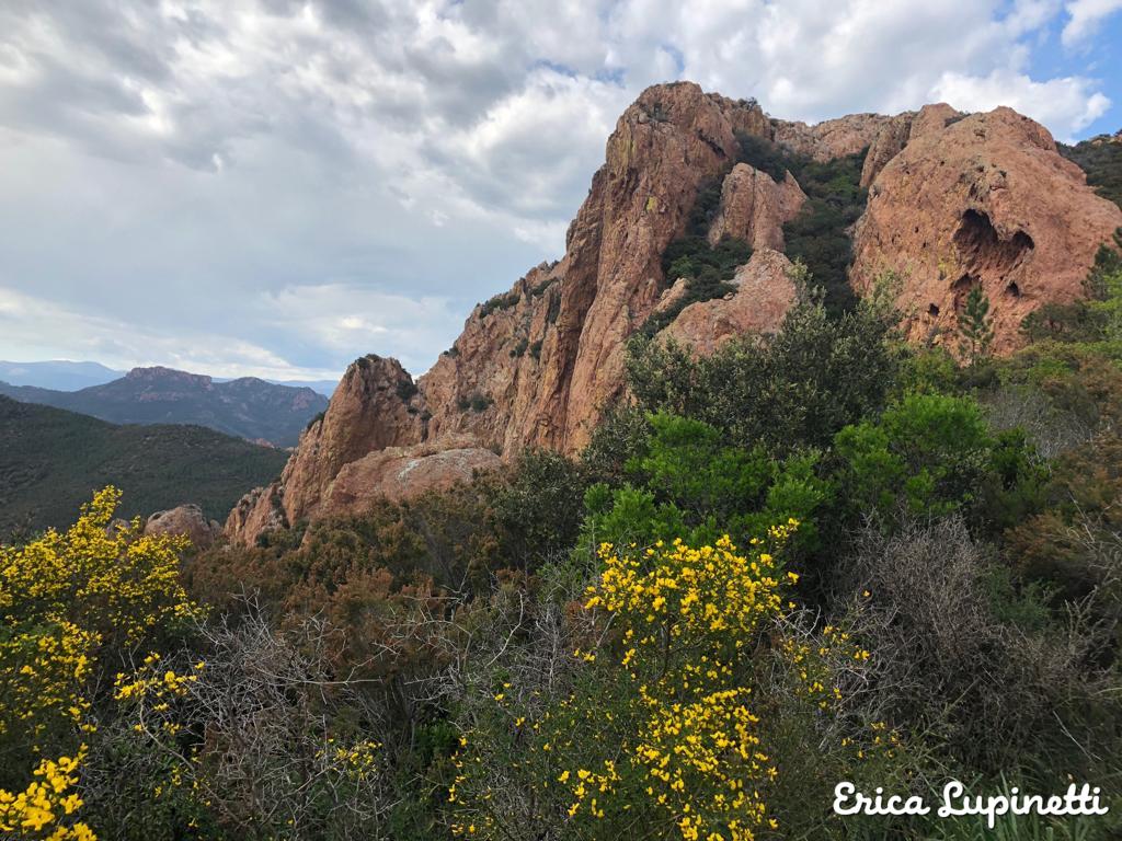
The scenery is particularly exotic and not frequent in France: deep red cliffs covered with lush Mediterranean vegetation stand in front of the immensity of the blue sea. The intense red colour of the rock comes from Rhyolite, a rock dating back to Paleozoic era of volcanic origin. The terrain is rugged, rocky and characterised by deep ravine, cliffs and local vegetation such as cork oaks, olive and carob trees, mimosas and Alep pines.
Trails frequently end or start near stunning coves perfect to bathe and get refreshed after walking for hours under the sun during summer! In February, this park is particularly recommended thanks to the year long mild temperatures of the region and to see the mimosa trees in full in bloom!
This article will help you to organise your next hike without the need of joining an organised tour. A web of multiple paths is available in the Esterel and a wide range of hikes appeal to amateur or experienced hikers.
Here is my hike selection:
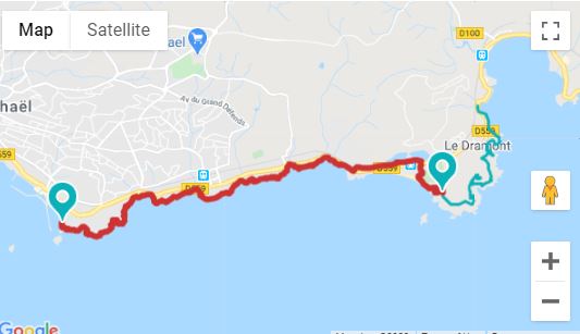
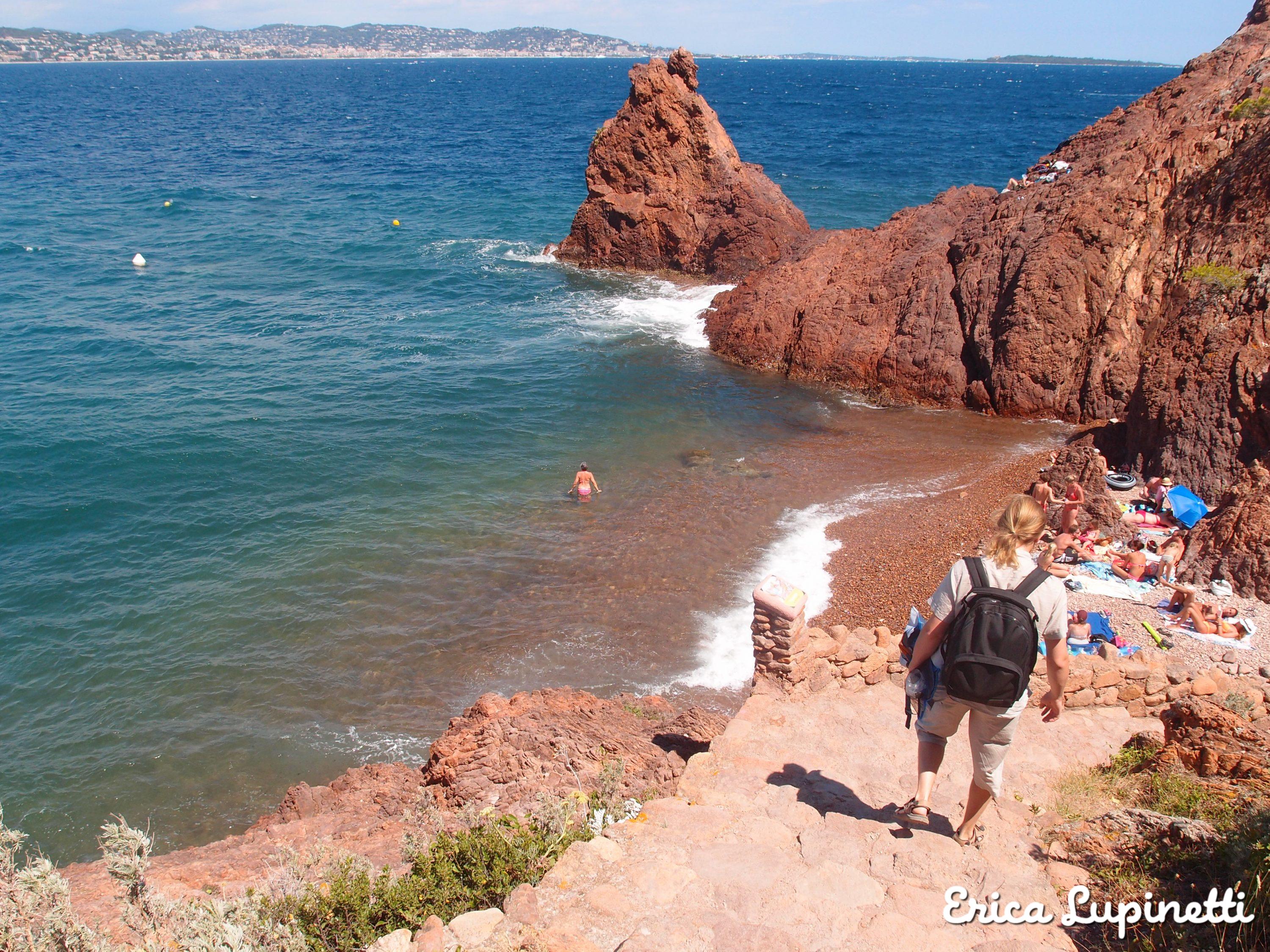
Cap Dramont
This scenic walk of 2 hours between red cliffs and the sea, is perfect for a first time visit to the park to have a first taste of the red rocky landscape you can expect from the Esterel. It is very frequent to see people rock climbing the red steep cliffs and many different paths lead to little red coves hidden by trees.
The Plage du Débarquement (the “landing beach”) is where Americans soldiers landed during the WWII to free the South of France from the German occupation. Today this historic place is a long pebbly beach which features a private beach and crystal clean waters.
During summer it is frequent to see little boats selling refreshments and ice-cream approaching the swimmers sunbathing or doing a picnic on the peaceful beaches.
Here is the path marked on Google Maps:
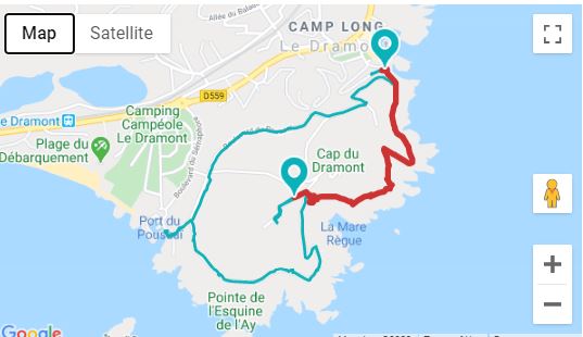
Where to start: the walk starts at the Plage du Débarquement near the Dramont train station. You can also start from Agay beach but you need to have a car and park at the Agay parking.
How to get here: from Nice, take the train and stop at “Le Dramont”. It is frequent that you need to stop at Cannes and take the train heading to “Les arcs de Draguignan”. It take around 1 hour from Nice-Ville.
Where to eat: preparing a picnic is the best option to eat while sunbathing on a volcanic red beach admiring the impressive Ile d’Or (the golden island) and its tower just in front of the Landing Beach. Otherwise you can have a lunch on the beach restaurant called “La plage de l’Ile d’Or” serving local and international food on the wooden terrace shaded by maritime pines.


Sentier du Littoral de St. Raphael
A 11 km trail stretches from the Plage du Débarquement, up to the Port Santa Lucia in St. Raphael. A series of pebbly or sandy reddish coves are tucked away at every turn. This 5h trail is reserved to trained hikers due to the length of the path and the multiple steps on the path.
This path is particularly scenic thanks to the amazing views over the famous Ile d’Or, a little rocky island which inspired the Belgian artist Georges Remi to write the Tin Tin Adventures. The little beaches are a real slice of heaven far from the crowds and perfect to spot fishes.
Here is the Google Map of the path:
Where to start: start at Port Santa Lucia in St. Raphael or start at the Plage du Camp near Le Dramont train station
How to get there: from Nice, take the train and stop in Cannes, take the train directed to “Les Arc de Draguignan” and stop at “Le Dramont”
Where to eat: You can eat at the beginning of the trail at the beach restaurant “La plage de l’Ile d’Or” on the Plage du Débarquement – great views guaranteed on the wooden terrace shaded by maritime pines. You can also bring a picnic and eat wherever you fancy along the trail: this is the cheapest and quietest option for sure. At the Port Santa Lucia, a good seafood restaurant is “La canne à sucre” preparing Mediterranean specialties such as Paella, grilled fish, fish soups, salads and delicious desserts

La Pointe de l’Aiguille
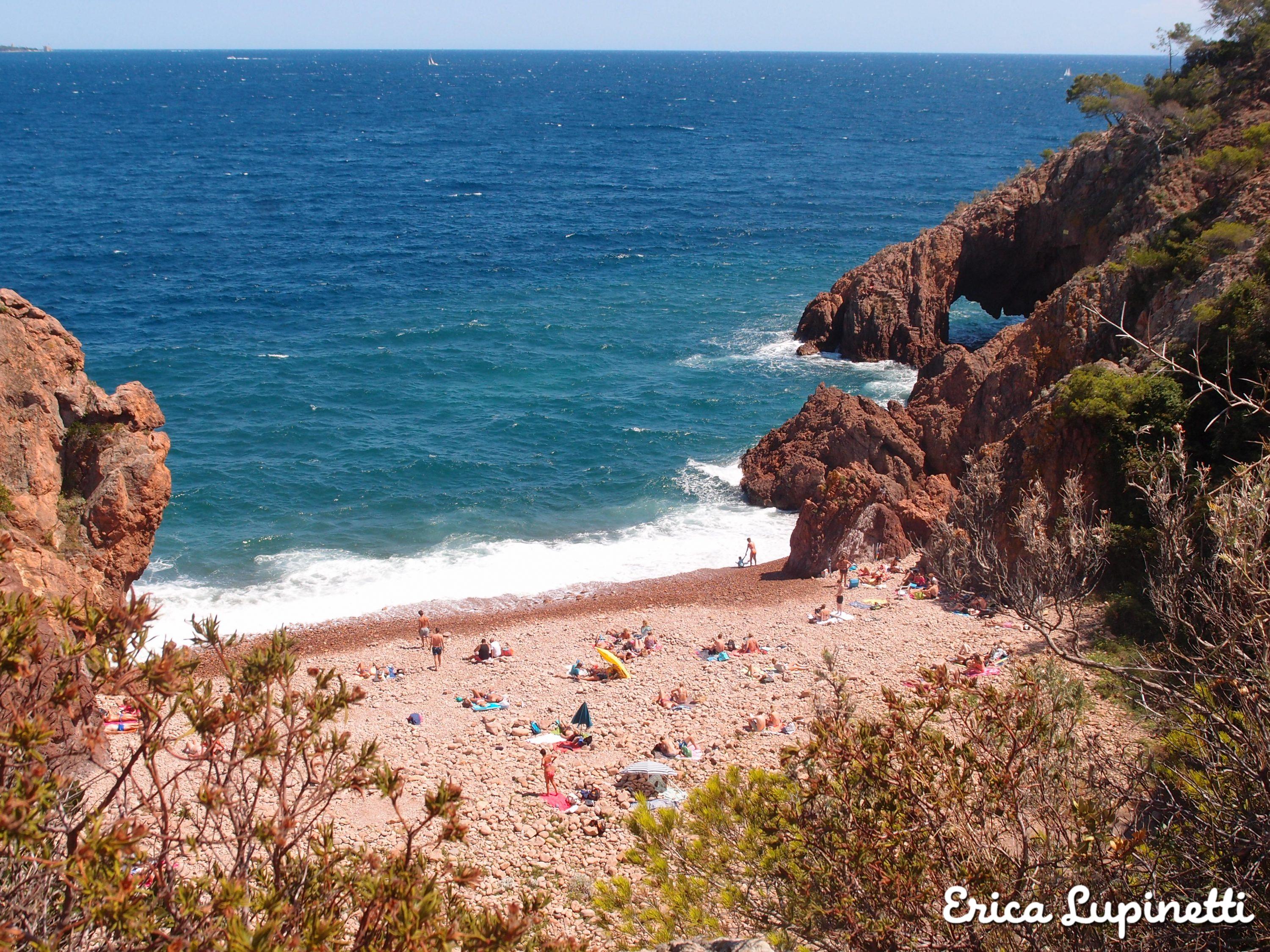
The Natural reserve of the Pointe de l’Auguille is a remarkable site which became popular for the little coves and its crystal waters encircled by, the lush local vegetation. From the Plage de l’Auguille, follow the wooden directions towards the Pointe de l’Auguille towards the Plage de Gardanne and its cave. Here from mid-June you will be able to follow a snorkelling path, an original idea for those who love to discover local fishes and the underwater world!
Théoule sur Mer is a tiny village surrounded by volcanic cliffs which increase the feeling of bein in an exotic location.
Here is the Randoxygène map of the trail:
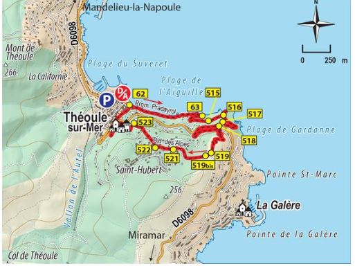
Where to start: from the Plage de l’Auguille follow the directions
How to get there: from Nice, take the train, stop in Cannes and take the train heading towards “Les Arcs de Draguignan” and stop at Théoule sur Mer.
Where to eat: pack a picnic or have a quick lunch at one of the lovely restaurants near the beach or a take-away sandwich or pizza at the snack bars along the little promenade.


Sentier du Cap Roux
This trail needs a car to head to the starting point but it’s definitely one of my favourite on the region! The views over the Esterel copper red majestic mountains is outstanding! From the Parking de la St. Baume, starting point for other trails as well, follow the directions for the Cap Roux. You can also visit the St. Honorat Cave and fountain adding a couple of km to your hike.
The 5 km hike is classified as hard because it lasts 4h30 but it has plenty of rocky sometimes steep paths leading to the top panoramic point. The hike is perfect for photography and nature lovers looking for some change of scenery.
Here is the Google map of the hike:
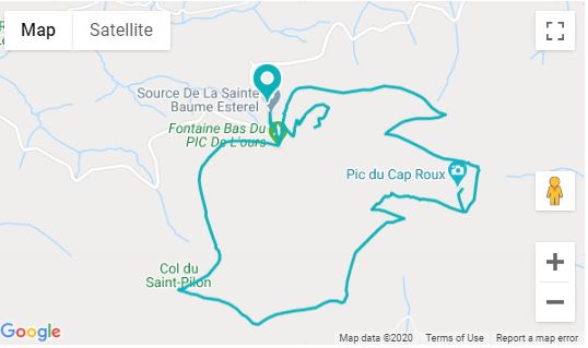
Where to start: From Agay, follow the direction heading to the Massif de l’Esterel, then follow the direction for the col of Notre-Dame and end up to the St. Baume Parking.
How to get there: by car from Nice, follow the directions for Cannes and then for Agay.
Where to eat: pack a picnic as there are no restaurant or kiosks in the park. You can eat in a restaurant in gay after or before the hike.
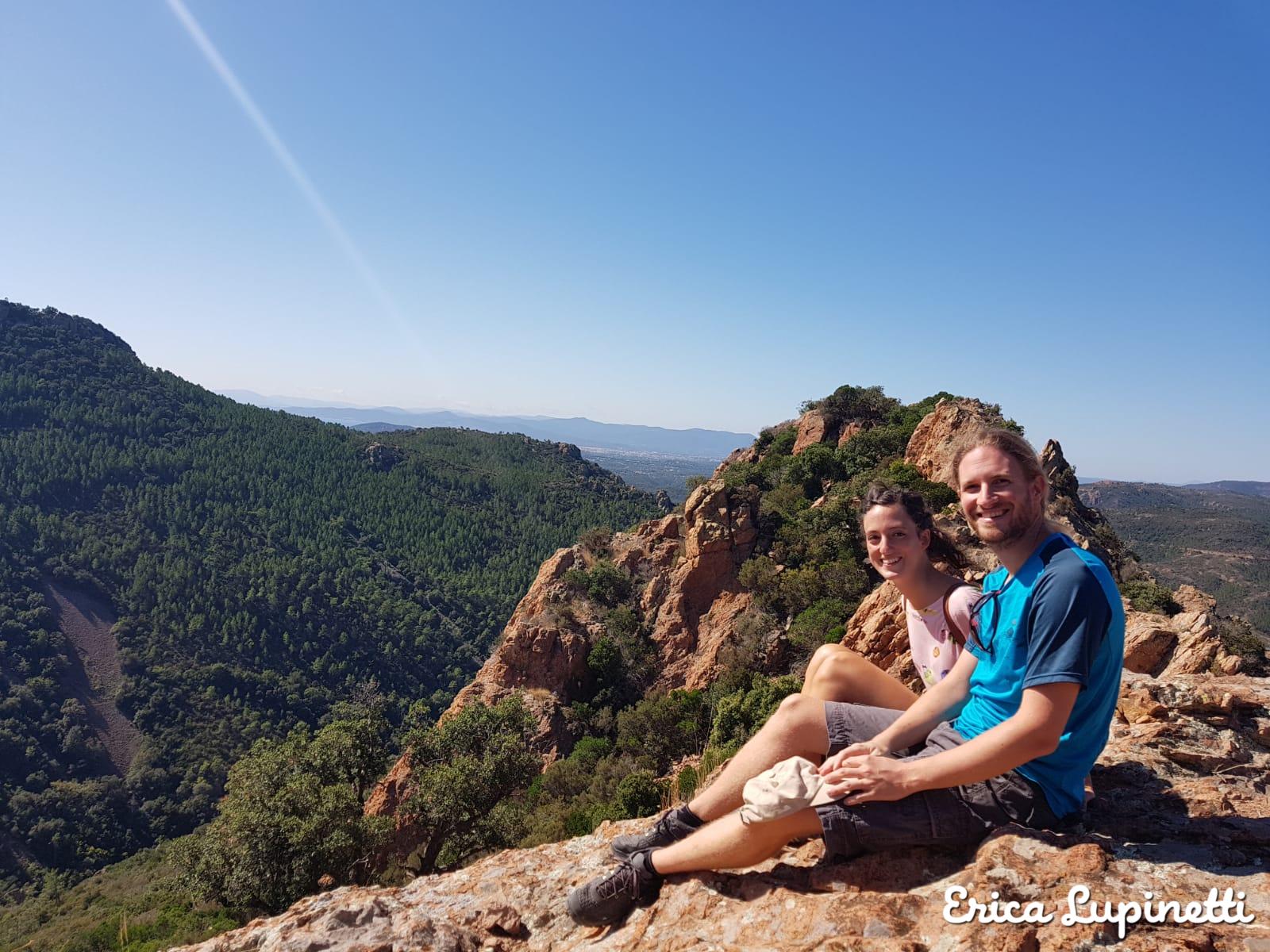
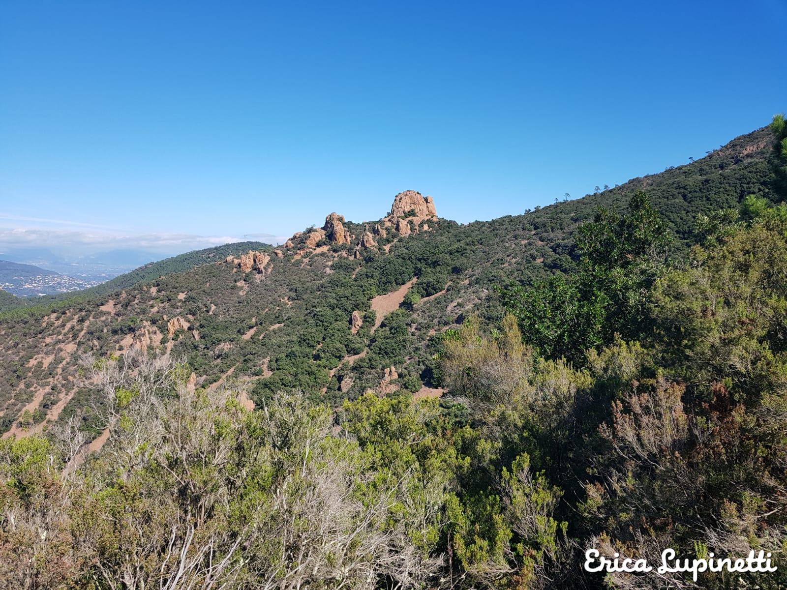
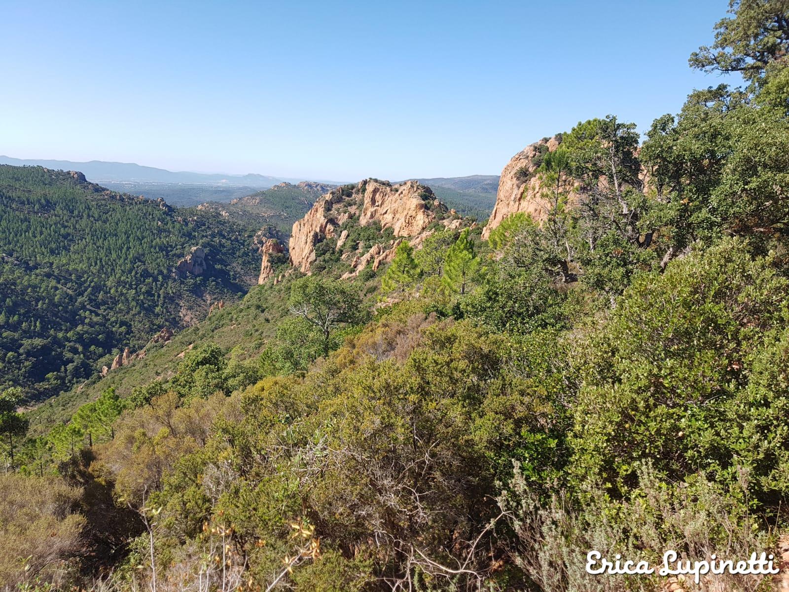
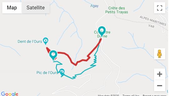
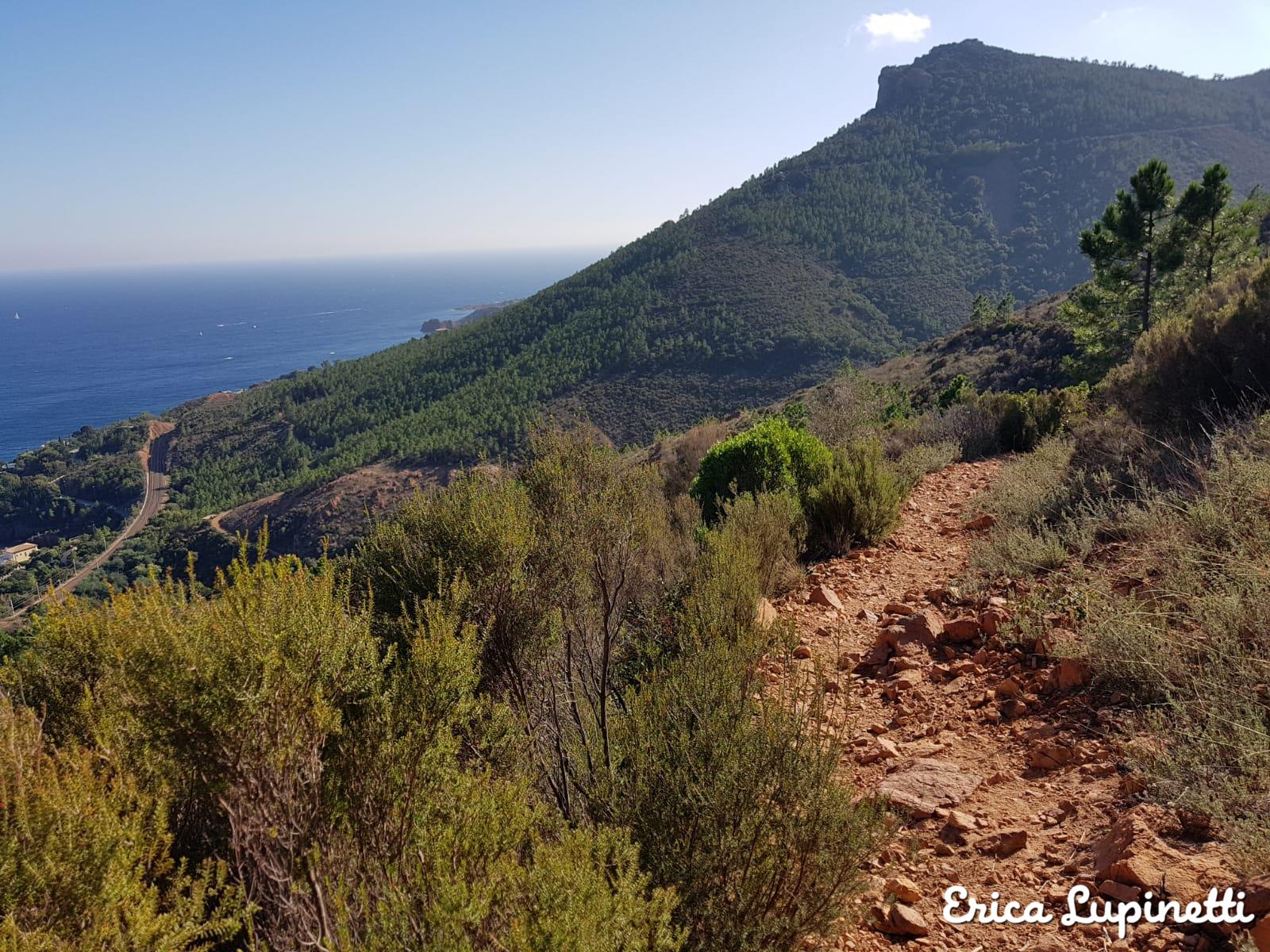
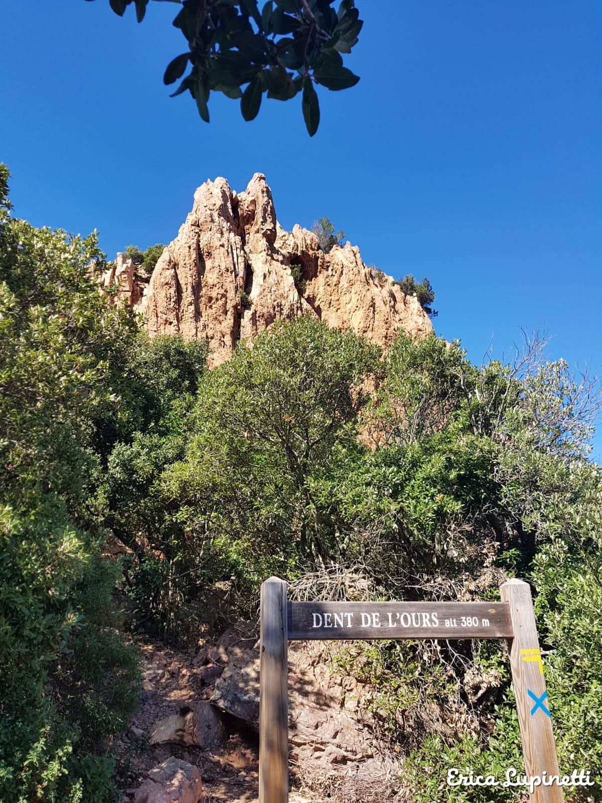
Sentier Pic de l’Ours
Starting from the Col de Notre-Dame this trail offers magnificent views over Cannes and the Mercantour mountains. The Dent de l’Ours is easily visible from the Col de Notre-Dame and it is so called because of its sharp shape.
The trail is only 2,5 km long but you can easily extend it following the difficult path heading to the Petites Clues and Grand Clues des Petits Trayas, a scenic trail leading you to a cork oak forest and steep paths leading to breath-taking views including a bit of climbing.
Here is the Google Map itinerary:
Where to start: from Nice, take the car and head to the Col de Notre-Dame. You could also take the train and stop at Le Trayas and follow the path 3/4 km long climbing to the Col de Notre-Dame.
How to get there: by car to the Col de Notre Dame parking or by train stopping at Le Trayas adding one hour to the climb.
Where to eat: pack a pic nic as this is a natural area and there are no restaurants.
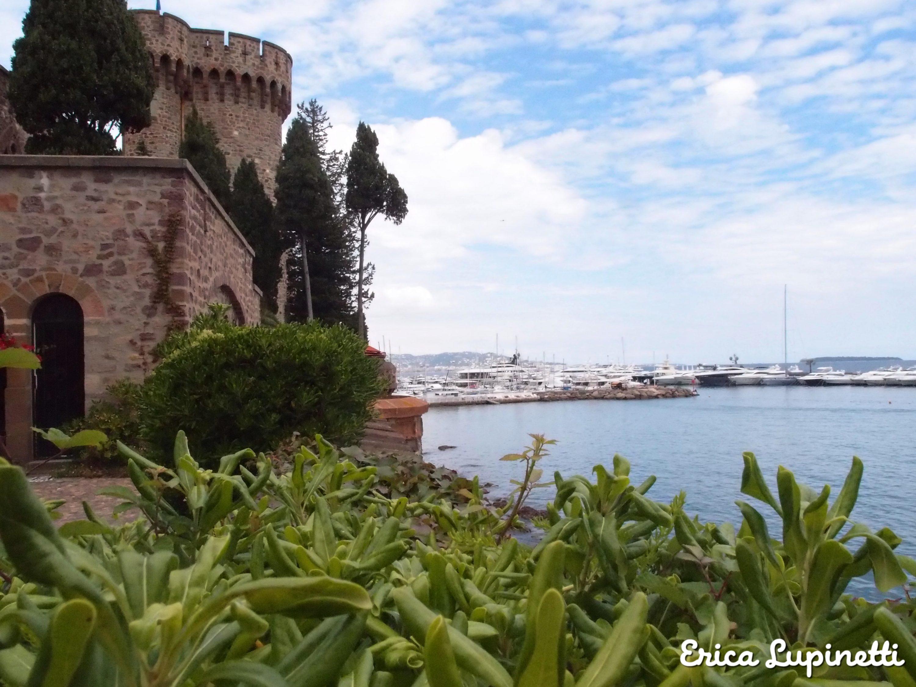
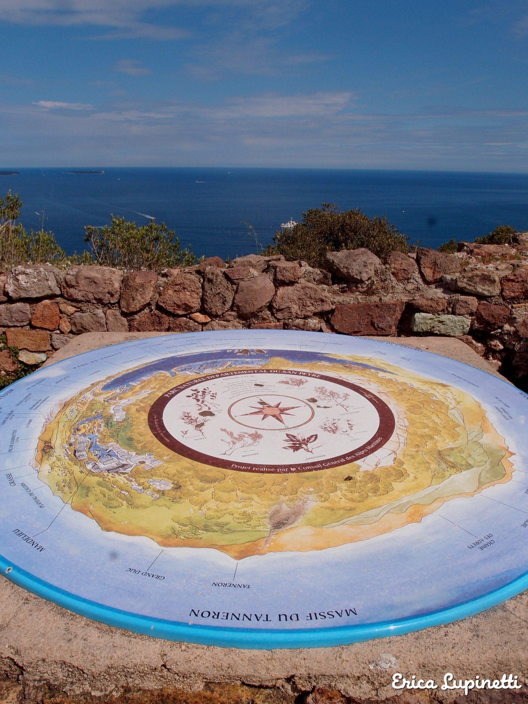
Sentier du Château de la Napoule – Coline du St. Peyre
An easier path not part of the Esterel National Park but with direct views over it, it’s the path of the Château de la Napoule an imposing red rocky building with perfectly conserved interiors which delights international visitors with beautiful gardens and views over the beach below.
The castle was refurbished by an eccentric couple of artists belonging to wealthy families who decided used to throw parties, and events for the whole village in their mansion and loved to welcome wild animals in the gardens.
Passing by Le Mont Turney, this 5 km easy trail ends stopping by the the local San Peyre hill in the Parc Forestal featuring an observatory and a panoramic point of view at the top. The hill is surrounded by cork oaks, olive trees and wonderful local Mediterranean vegetation. Finish the walk taking a refreshing bath on the sandy Plage de la Raguette.
Here is the Randoxygène hike link:
Where to start: start at the Château de la Napoule, reach de Chemin de Douaniers running beside the beach and follow the directions toward the Mont Turney.
How to get there: either by car stopping at Mandelieu la Napoule or take the train and stop at Mandelieu la Napoule.
Where to eat: pack a picnic and eat at the top of the St. Peyre hill or on the beach.


O 
Did you find this article useful to organise your next hikes in the region? Then check my top list of day trips from Nice.